About Pix4Dcapture
Pix4Dcapture turns your consumer drone into a professional drone mapping tool. A free companion to Pix4D photogrammetry software, Pix4Dcapture is the perfect tool to automatically capture image data - RGB, thermal - for...
Pix4Dcapture turns your consumer drone into a professional drone mapping tool. A free companion to Pix4D photogrammetry software, Pix4Dcapture is the perfect tool to automatically capture image data - RGB, thermal - for optimal 3D models and maps. Process post-flight images easily on the cloud or desktop applications, producing georeferenced maps and models that are tailored to many industry needs.
Currently, the app supports and was tested for the following drones:
• DJI
- Phantom 4 Pro v2.0
- Phantom 4 Pro
- Phantom 4
- Mavic 2 Pro
- Mavic Pro
- Mavic Air
- Matrice 200
- Matrice 210
- Matrice 210 RTK
- Inspire 2
- Inspire 1 (Pro)
- Phantom 3 Professional
- Phantom 3 Advanced
- Phantom 3 Standard
- Matrice 100
- Spark
• Parrot
- Anafi with Skycontroller 3
- Anafi Thermal with Skycontroller 3 (RGB + Thermal Images)
- Bluegrass with Skycontroller 2
- Bebop 2 with Skycontroller 2
• Yuneec
- H520 with E90 camera and ST16S controller (compatible version available from support page)
Features and benefits:
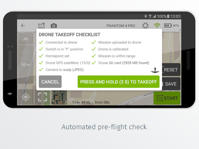
- Fully automated drone mapping
- Drone telemetry and camera live feed during the image acquisition
- Different flight plans for different needs
- Polygon Mission for general mapping
- Grid Mission for general mapping
- Double Grid Mission for better 3D model reconstruction
- Circular Mission for point-of-interest 3D model reconstruction
- Free Flight Mission for vertical object mapping with manual flight control
- Flight parameters for each mission - front & side image overlap , camera angle , altitude ,
flight speed - can be adjusted based on the requirements of the area.
- Save or duplicate missions to fly the same area of interest several times
- Combine several missions into one project in the project manager
- Precise mission planning by importing KML/KMZ files
- Store the basemap with your flight plan using offline maps
- Change street/satellite basemap provider
- Seamless workflow with Pix4D’s processing software
- Automated image transfer from drone-to-device
- Upload images directly from the device to Pix4D software in the cloud for processing (license required)
Post-flight processing & analysis using Pix4D’s software on cloud or desktop:
- Achieve survey-grade results from lightweight and compact cameras to large-frame metric cameras
- Usage of Ground Control Points (GCPs) for improving the relative and absolute accuracy of the model
- Generate and modify
- Point clouds
- Orthomosaics
- Digital elevation models (DSM/DTM)
- Index maps (e.g. NDVI)
- And more
- Measure distances , surfaces , and volumes
Important information:
Ensure you have the latest firmware installed on your drone and the app is up to date. The app follows the flight plan and does not avoid obstacles automatically. Pix4D accepts no liability for damage, injuries or legalities from the misuse of this app. Use only in safe environments.
Previous Versions
Here you can find the changelog of Pix4Dcapture since it was posted on our website on 2016-11-02 17:47:55.
The latest version is 4.11.0 and it was updated on 2024-04-19 23:28:33. See below the changes in each version.
Pix4Dcapture version 4.11.0
Updated At: 2021-06-16
Changes: This version is only compatible with Anafi firmware 1.8.0, please upgrade your drone to the last firmware available.
Pix4Dcapture version 4.10.0
Updated At: 2020-10-26
Changes: What's new
* Support for Anafi USA
* Pix4Dcloud trial license is created for new users that sign up
Improvements
* Updated to the latest GroundSDK
* Updated to the latest DJI SDK
Notes
* This version is not compatible with Anafi firmware 1.6.8 or below
Pix4Dcapture version 4.9.0
Updated At: 2020-05-28
Changes: Improvements
* Updated to support latest Parrot Anafi firmware
* Rectilinear format for Parrot Anafi photos for wider compatibility
* Offline maps bug fixes
* Third party acknowledgments in the about section
* Bug fixes
Pix4Dcapture version 4.8.0
Updated At: 2020-01-30
Changes: What's new
* Support for Parrot Anafi Thermal (RGB + Thermal Images)
Improvements
* Bugfixes
Pix4Dcapture version 4.7.0
Updated At: 2019-12-13
Changes: What’s new
- DJI SDK update to 4.11
- Android 10 support for DJI drones
- Improved video for Mavic 2 Pro
- Parrot GroundSDK update to 1.1.0
Fixes & improvements
- Small UI tweaks (improved mission & sync notifications)
Pix4Dcapture version 4.6.0
Updated At: 2019-10-24
Changes: What’s new
- 64 bit / Android 10 compatibility
- Anafi Thermal support (RGB only for now)
Fixes & improvements for Anafi
- Improved image triggering reliability
- Safer landing location at end of mission
- Image download crash
Notes
- Ctrl+Parrot 2 is no longer required: you will be prompted to uninstall it
- DJI CrystalSky, Yuneec H520 & ST16S
- This version requires Android 7+ and is not compatible with CrystalSky or ST16S
- Latest compatible version can be found on our support page
Pix4Dcapture version 4.5.0
Updated At: 2018-12-18
Changes: New
* Support for DJI Mavic 2 Pro
Improvements
* Fixed issue affecting upload of projects containing unicode characters
* Improved support for Parrot Anafi
* Bug fixes
Known Issues
* No live video stream for Mavic 2 Pro
Pix4Dcapture version 3.5.1
Updated At: 2016-12-28
Changes: - Increases image capture reliability,- Improves X5 support,- No longer requires email permissions for opening KML attachments,- Bug fixes
Pix4Dcapture version 3.3.1
Updated At: 2016-10-21
Changes: - support for alternate map providers,- much faster upload to the cloud,- project sharing,- bug fixes
Disclaimer
Official Google Play Link
We do not host Pix4Dcapture on our servers. We did not scan it for viruses, adware, spyware or other type of malware. This app is hosted by Google and passed their terms and conditions to be listed there. We recommend caution when installing it.
The Google Play link for Pix4Dcapture is provided to you by apps112.com without any warranties, representations or guarantees of any kind, so access it at your own risk.
If you have questions regarding this particular app contact the publisher directly. For questions about the functionalities of apps112.com contact us.